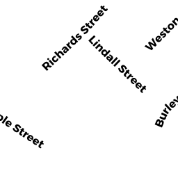
24 RICHARDS ST
Owner Information
CLICKSTEIN JEFFREY S
24 RICHARDS ST
DANVERS, MA 01923


Property Details
24 RICHARDS ST is classified as a Single Family Residential (Colonial).
The primary structure on this property was built in 1995. There are 3142ft2 of built area within this property. There is 3142ft2 of residential/living space within this property. This property is listed as having 8 rooms.
24 RICHARDS ST is valued at 693500. The land is valued at 294400 and the structures are valued at 390100. There is an additional valuation of 9000 on this property.
This property is in Zone R2. Confirm with local Zoning Board authorities to ensure there are no overlays or other easements on this property.
24 RICHARDS ST was last sold on 2000-05-19 for 0.
Assessment data from fiscal year 2022.
Flood Data
According to the FEMA National Flood Hazard Layer, this property does not appear to be in a flood zone. It may also be in an area not yet reviewed. Nonetheless, confirm this information prior to taking any action.
To view the flood hazards around this property, create a FEMA "Firmette" Map of the area around 24 RICHARDS ST.
Broadband Internet Providers
| Provider | Type | Bandwidth (mbps) | |
|---|---|---|---|
| VSAT Systems, LLC. | Satellite | 2 | 1 |
| Verizon New England Inc. | DSL | 10 | 1 |
| Verizon New England Inc. | Fiber | 940 | 880 |
| Comcast | Cable | 1000 | 35 |
| Broadview Networks Holdings, Inc. | Copper Wire | 0 | 0 |
| GCI Communication Corp. | Satellite | 0 | 0 |
| Viasat Inc | Satellite | 100 | 3 |
| HughesNet | Satellite | 25 | 3 |
Broadband service provider data from December 2020.
Adjacent Properties
- 75 LINDALL ST
Care and Treatment Facilities - designed and used on a transient basis, including half-way houses and similar facilities owned by 75 LINDALL STREET LLC - 36 FELLOWS ST
Single Family Residential owned by MIZZI SCOTT - 30 WESTON ST
Single Family Residential owned by DUGGAN SUSAN M. - 26 WESTON ST
Single Family Residential owned by BALDWIN NANCY M - 18 RICHARDS ST
Single Family Residential owned by BROWN WILLIAM R